Subject: Colonial Southeast United States
Period: 1706 (published)
Publication:
Color: Black & White
Size:
9 x 6 inches
22.9 x 15.2 cm
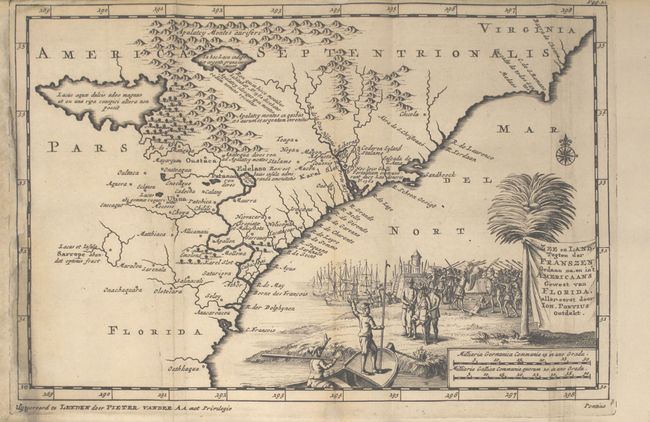
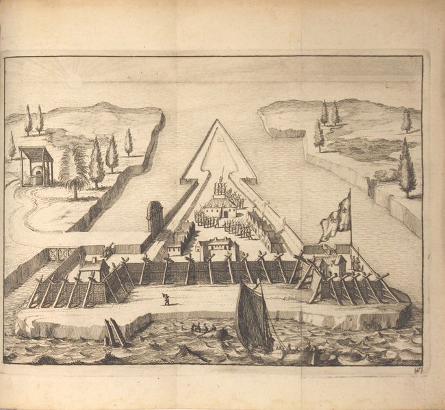
Interesting Dutch account of Spain's colonial establishment in the Southeast and Florida with one map and 30 (of 33) beautifully engraved views. The book includes the accounts of the explorers Jean Ribault and Rene de Laudonniere. The views show scenes of native ceremonies, cannibalism, battles, and fortification plans. The outstanding map of the Southeast, based on the Mercator/Hondius prototype, shows the geography derived from the accounts of John Lederer, who described large interior lakes, an area of savanna at the foot of the Apalatcy Montes auriferi, and a desert region. Two French forts built by Ribaut in 1562 and Laudoniere in 1564 are labeled Karel Slot. The map is beautifully engraved with a large pictorial title cartouche depicting the landing of Ponce de Leon and a battle scene with the natives. The book contains 171 pages with an 18-page Register in the back; missing plates 10, 29 and 32. Rebound in marbled paper (19th century), lacking covers.
References:
Condition: A
The map is clean, bright and professionally remargined at left with a minor amount of neatline replaced in facsimile. The plates are mostly clean and bright in near fine condition. Two have tears that extend less than 1" into image, and one has a long cut in the image (from having adjacent engraving removed) that is closed on verso with archival tape. The text is also clean and bright. The wrappers show light wear.