Catalog Archive
Auction 155, Lot 180

"Map of the States of Maryland and Delaware", Morse, Jedidiah (Rev.)

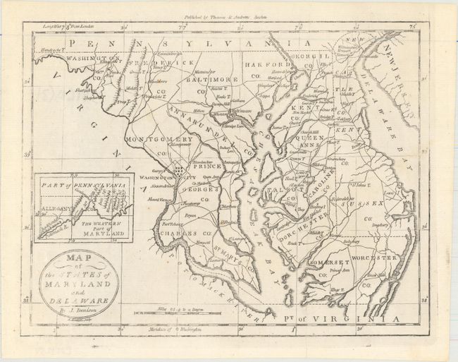
Subject: Maryland & Delaware

Period: 1796 (circa)

Publication: The American Universal Geography

Color: Black & White

Size:
9.6 x 7.4 inches
24.4 x 18.8 cm
Download High Resolution Image
(or just click on image to launch the Zoom viewer)

This is the first state of this detailed map that includes all of the Chesapeake Bay and locates Washington City. At left is an inset, The Western Part of Maryland, that names the Potomack River and several mountain ridges. Counties are named and delineated. The map also shows towns, roads, topography, and good watershed detail. Drawn by James Denison, engraved by Amos Doolittle, and published by Thomas & Andrews, Boston.

References: McCorkle (18th C. Geography) #304-10; Wheat & Brun #514.

Condition: A

Issued folding with a few tiny, negligible spots. The impression is a bit weak in the title cartouche and portions of the border.

Estimate: $180 - $220

Sold for: $150

Closed on 11/18/2015

Archived