Subject: New York & New Jersey
Period: 1796 (circa)
Publication: The American Universal Geography
Color: Black & White
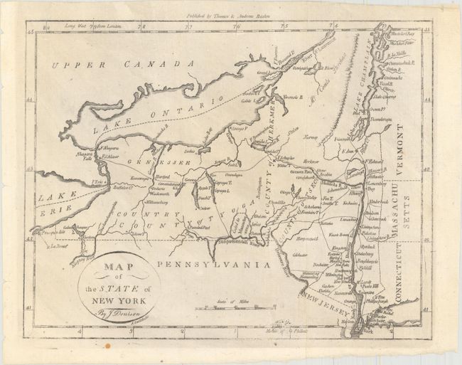
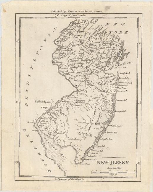
These early state maps from Morse's The American Universal Geography show topography, watershed, town names, and more. Meridians are from both London and Philadelphia. Published by Thomas & Andrews, Boston.
A. Map of the State of New York, (9.6 x 7.4"). In the lower portion of the state there is an area marked Ceded to Massachusetts. Chautauqua Lake appears as Calaughaque L. Drawn by J. Denison, engraved by Amos Doolittle.
B. New Jersey, (5.6 x 7.4"). The distance scale is in "American Miles." The area extends from the tip of Long Island, Manhattan to details of the shoals in Delaware Bay. Engraved by Samuel Hill.
References: McCorkle (18th C. Geography) #304-7 & 8; Wheat & Brun #368 & #417.
Condition: A
Clean and bright, issued folding.