Subject: Colonial Eastern United States & Canada
Period: 1752 (dated)
Publication: Memoire dans Lequel on Compare la Canada a la Suisse...
Color: Black & White
Size:
12.1 x 10.9 inches
30.7 x 27.7 cm
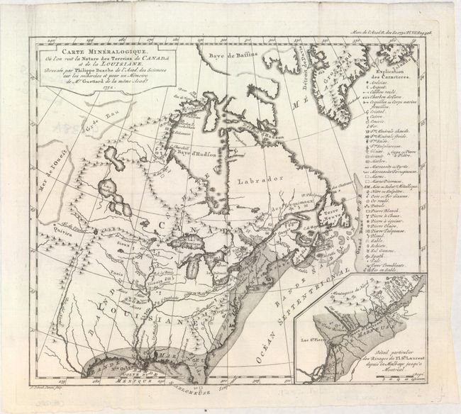
This rare map represents Guettard's efforts to create the first geological map of North America. Drawn by Philippe Buache, the map has an ambitious legend identifying an amazing 39 different geological formations and types. The map also has interest for its inclusion of the cartographic curiosity Mer de l'Ouest (Sea of the West) that is shown as occupying part of western Canada. This imaginary feature appeared in a series of Buache's maps of North America and its derivatives, each showing the sea shrinking in size and prominence as continued exploration failed to prove its existence. The mythical Quivira is named as well. The inset map at lower right notes eight places containing fossils. Engraved by Leonard Schenck Jansz. Despite the 1752 date, this was first published in Paris in 1756.
References: Marcou #24; McCorkle #752.2.
Condition: A
A bright, clean example. Issued folding with a short fold separation in the top blank margin.