Subject: Rugen, Germany
Period: 1619 (published)
Publication: Gerardi Mercatoris - Atlas sive Cosmographicae
Color: Hand Color
Size:
19.1 x 14.8 inches
48.5 x 37.6 cm
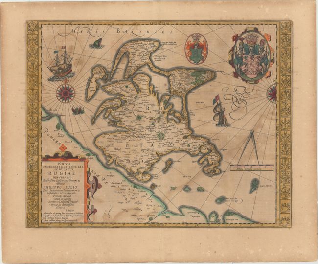
This striking map of the island of Rugen is filled with decorative elements, and is based on a map by Eilhard Lubbin, a mathematician and cartographer from Rostock. Flanking the map are 30 coats of arms of the leading families on the island. In the top right corner of the map are the coats of arms of Rugen and the Duchy of Pomerania. Additional embellishments include ships, compass roses, sea monsters, and a distance scale supporting large measuring dividers. A crack in the plate is visible adjacent to the title cartouche. French text on verso.
References: Van der Krogt (Vol. I) #2192:1A.
Condition: B
A fine impression with full original color, color offsetting, light toning, and light scattered foxing primarily confined to the blank margins.