Subject: Northern & Eastern France
Period: 1593 (published)
Publication: Speculum Orbis Terarrum
Color: Black & White
Size:
17.6 x 13.6 inches
44.7 x 34.5 cm
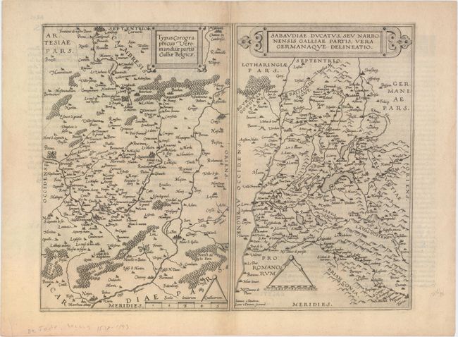
A rare copper engraving with two maps on one sheet. At left is the historic region of Vermandois (in Picardy) centered on St-Quentin, extending as far north as Cambrai and south to Noyon. At right is a map of the Savoy region, centered approximately on Geneva, Switzerland, with Lyon to the west. Each map is adorned with a strapwork title cartouche and a distance scale with dividers. Engraved by Joannes and Lucas van Deutecum. Latin text on verso.
Cornelis de Jode (1568-1600) was the son of the mapmaker and publisher Gerard de Jode. The elder published several important maps including Ortelius' famous 8-sheet map of the world in 1564. His major atlas, Speculum Orbis Terrarum was a commercial failure because his rival, Abraham Ortelius, was able to obtain a monopoly for eight years at the same time De Jode was preparing the publication. After Gerard's death, his widow and son enlarged the atlas and re-issue it in 1593. On the death of Cornelis, the copper plates were sold to J. B. Vrients, who acquired them merely to stop their re-issue, as he had also acquired the Ortelius plates. De Jode maps are rarely offered on the market.
References: Shirley (BL Atlases) T.JOD-1c; Van der Krogt (Vol. III) #4160+4770:32.
Condition: B+
Watermarked paper with minor offsetting and a hint of toning along centerfold.