Subject: Cartographic Miscellany
Period: 1893 (published)
Publication: Yaggy's Geographical Portfolio
Color: Printed Color
Size:
33.8 x 22 inches
85.9 x 55.9 cm
Originally issued as an educational aid, these charts are among the most distinctive and stunning comparative charts ever published. Unlike the smaller, simpler and more analytical comparative charts found in atlases, Yaggy's images present a living landscape set with an exaggerate scale which gives each a strange and other-worldly appearance. These are exquisite and scarce examples of multi-stone lithography with each stone carrying a different color ink to build up the image to a complex, beautiful image. We count at least six different colors and perhaps as many as eight. Yaggy wrote and published several books ranging from healthful living to ancient history culminating with large format anatomical and geographical studies intended for the classroom market.
This lot contains the title page and 3 prints each backed with original linen:
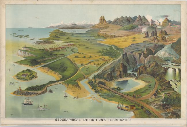
A. Geographical Definitions Illustrated. This sheet shows and names various geographic terms, such as harbor, sound, glacier, rapids, fissures, oasis, and many others.
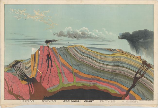
B. Geological Chart. This chart shows the various geological eras as well as the various key events in each ear. In the sky are various types of clouds, which are named in a key at the bottom of the chart.
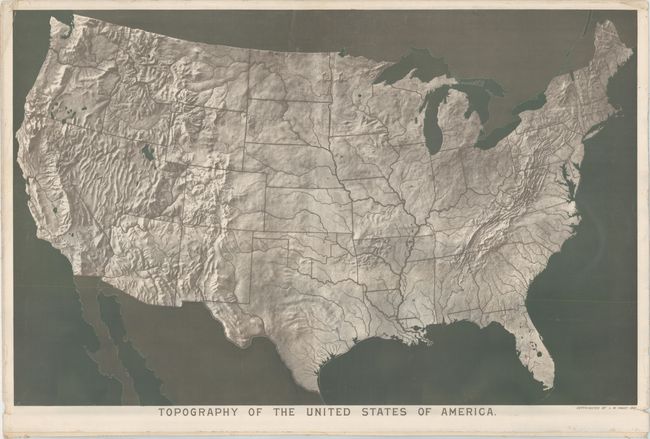
C. Topography of The United States of America. This topographical chart shows the contiguous US, with each of the states depicted in outline.
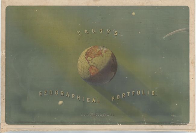
D. Yaggy’s Geographical Portfolio . Depicts the Earth with a focus on the Western Hemisphere, surrounded by other planets and stars.
References:
Condition: B+
The prints are in very good to near fine condition with vivid colors, minor soiling and some edge cracks and tiny tears mostly at bottom that barely impact the image. The Geographical Definitions chart has a small abrasion in the sky. The title page has understandably a bit more wear with some cracking at the bottom of the image and light soiling (B).