Catalog Archive
Auction 153, Lot 447

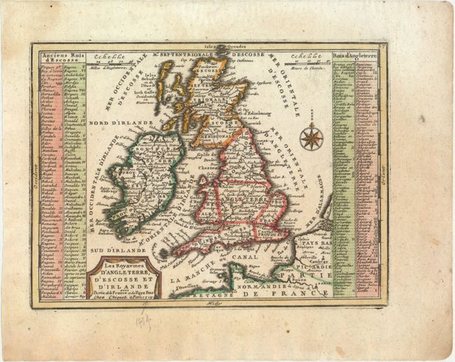
"Les Royaumes d'Angleterre, d'Escosse et d'Irlande avec Partie de la France et des Pays Bas", Chiquet, Jacques
Subject: Britain

Period: 1719 (dated)

Publication: Le Nouveau et Curieux Atlas Geographique et Historique

Color: Hand Color

Size:
8.8 x 6.5 inches
22.4 x 16.5 cm
Download High Resolution Image
(or just click on image to launch the Zoom viewer)

A lovely, small map of England, Wales, Scotland and Ireland with a portion of the coastline of France and the Netherlands. The map is quite detailed for its small size and is flanked with panels listing the ancient kings of Scotland on the left and the kings of England on the right, ending with King George I.

References: Mickwitz & Miekkavaara #43-15.

Condition: A

A clean, bright example on watermarked paper with a pencil notation entering border at bottom.

Estimate: $160 - $190

Sold for: $100

Closed on 5/20/2015

Archived