Catalog Archive
Auction 153, Lot 412

"Kaart van Geheel Guajana of de Wilden-Kust, en die der Spaansche Westindien, op het Noord-end van Zuid-Amerika", Tirion, Isaac

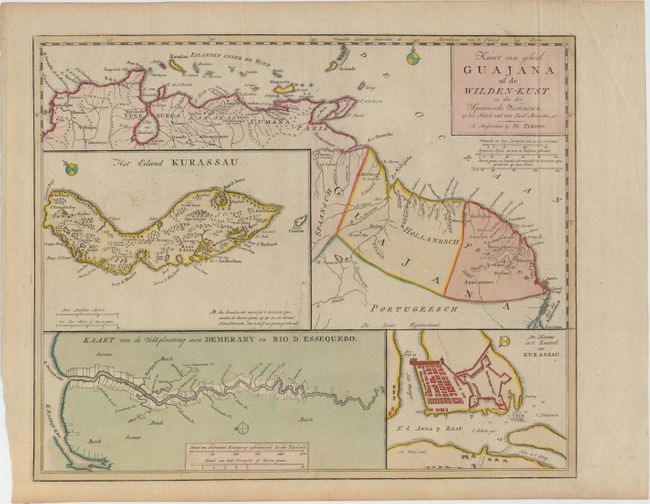
Subject: Guyana, Suriname, French Guiana

Period: 1750 (circa)

Publication: Hedendaagsche Historie, of Tegenwordige Staat van Amerika

Color: Hand Color

Size:
15.9 x 13 inches
40.4 x 33 cm
Download High Resolution Image
(or just click on image to launch the Zoom viewer)

Handsome and interesting map of the northern coastline from Colombia through French Guyana. Includes three large insets of the island of Kurassau (Curacao), a detailed map of the harbor and Dutch fort on Curacao, and a map of the Dutch colony of Demerary and Essequebo showing plantations along the rivers.

References: Shirley (BL Atlases) G.TIR-1a #18.

Condition: A

Original color on watermarked paper with a hint of toning. There is an extraneous crease along the plate mark at right, which has been archivally reinforced on verso.

Estimate: $450 - $550

Unsold

Closed on 5/20/2015

Archived