Catalog Archive
Auction 152, Lot 588

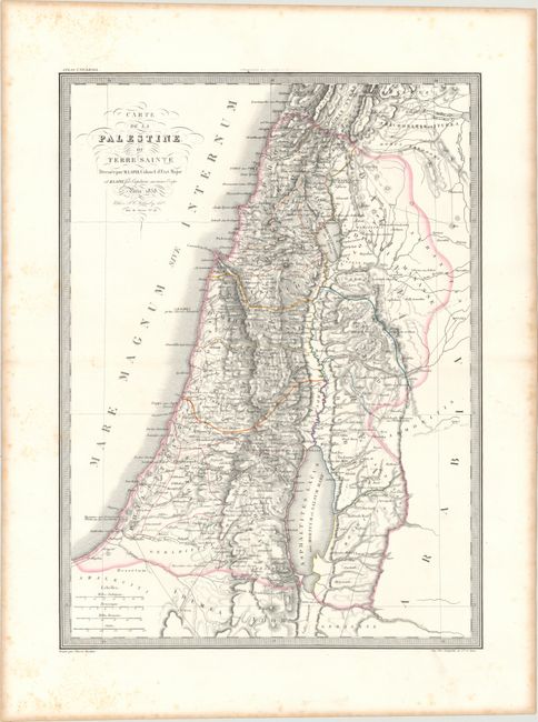
"Carte de la Palestine ou Terre Sainte", Lapie/Tardieu

Subject: Holy Land

Period: 1838 (dated)

Publication: Atlas Universel

Color: Hand Color

Size:
15.9 x 21.8 inches
40.4 x 55.4 cm
Download High Resolution Image
(or just click on image to launch the Zoom viewer)

Beautifully engraved and highly detailed map of the Holy Land divided into the twelve tribes. The map shows excellent detail of the topography of the land and is filled with ancient place names. Surrounded with a decorative keyboard-style border.

References:

Condition: A

A fine impression with original outline color on a bright sheet with light scattered foxing that is mostly confined to the blank margins and toning along the sheet's edges.

Estimate: $95 - $120

Sold for: $60

Closed on 2/18/2015

Archived