Catalog Archive
Auction 152, Lot 269

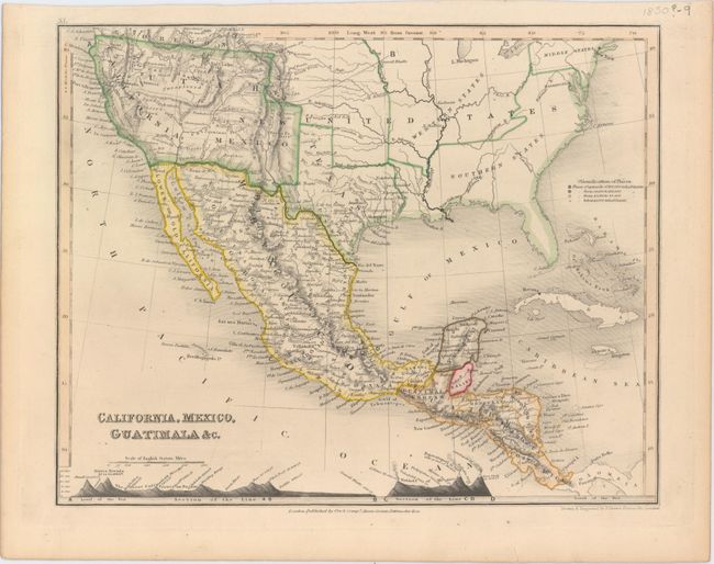
"California, Mexico, Guatimala &c.", Dower, John
Subject: United States & Mexico

Period: 1850 (circa)

Publication:

Color: Hand Color

Size:
10.3 x 8.2 inches
26.2 x 20.8 cm
Download High Resolution Image
(or just click on image to launch the Zoom viewer)

This crisply engraved map shows the United States in control of the entire southwest. Texas is depicted closer to its present-day borders, and the west is taken up by California and huge Utah and New Mexico territories. A large portion of the Great Basin is labeled "unexplored" directly above an east-west mountain range. At bottom are two elevation profile views: one from Council Bluffs, Iowa to the Pacific, and the other from Colina, Mexico to the Gulf of Mexico. Published by Orr & Company.

References:

Condition: A

Original outline color with a tiny tear in bottom blank margin.

Estimate: $100 - $130

Sold for: $50

Closed on 2/18/2015

Archived