Subject: Scotland
Period: 1750-1856 (circa)
Publication:
Color:
Attractive set of maps focused on Scotland including:
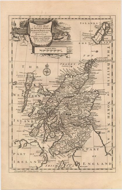
A. A New Map of Scotland or North Britain. Compiled from Surveys…,, from New Geographical Dictionary..., circa 1750, black & white (7.8 x 11.3"). Very detailed map with numerous place names and good coastal detail. Adorned by a decorative title cartouche.
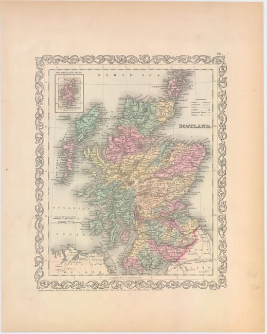
B. Scotland, by Charles Desilver, dated 1856, hand color (9.8 x 12.0"). Attractive map in original color and very wide margins with an inset of the Shetland Islands at top left. Surrounded by a strapwork border.
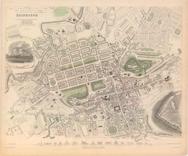
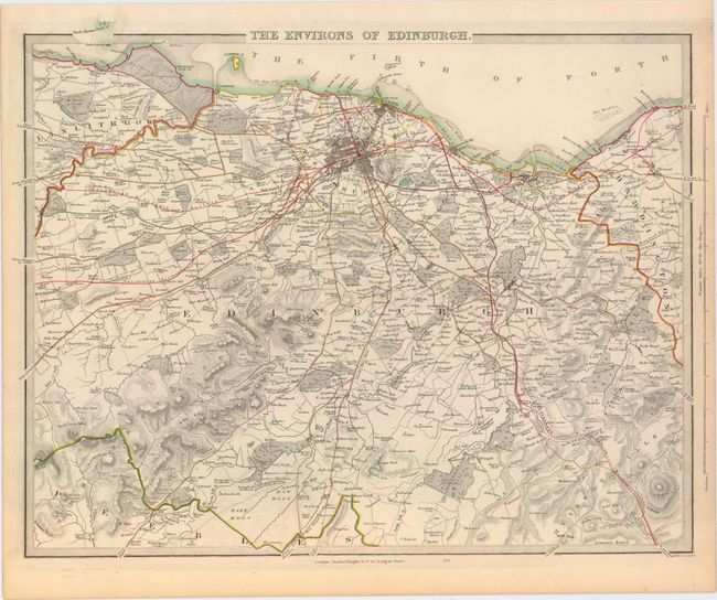
C. [Lot of 2] Edinburgh [and] The Environs of Edinburgh, by SDUK Society for the Diffusion of Useful Knowledge, circa 1834, hand color (15.5 x 12.0"). This pair of steel engraved maps shows the city in minute detail. The first is decorated by a large and beautifully engraved vignette of Edinburgh Castle and facades of the seventeen most important structures of the city. The second is filled with information including roads, lanes, villages, towns, mills, castles, watershed and terrain. Locates individual buildings and some fields with the landowner's family name. Extends to the east to beyond Musselburgh, west to Kirkliston and south to Rutherford Castle and Pennicuik.
References:
Condition: A