Subject: Southeastern England
Period: 1782-1890 (circa)
Publication:
Color:
This lot includes four maps from over a century of cartographic history detailing areas in southeastern England in and around London.
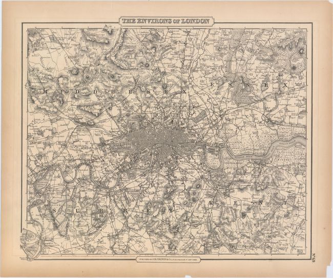
A. The Environs of London, by Joseph Hutchins Colton, dated 1855, black & white (14.6 x 12.3"). This detailed plan covers the city and its surroundings from Southgate south to Mitcham and Kingston east to Woolrich. The River Thames is central, and several parks, railroads, marshes, hills, bridges, and more are shown. Condition: A crisp impression with two small chips and a few edge tears, all of which are confined to the blank margins, with the exception of one that grazes the neatline at bottom. (A)
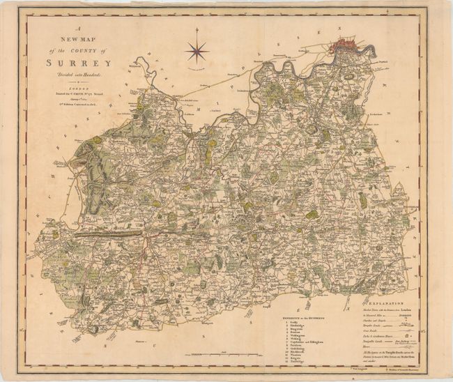
B. A New Map of the County of Surrey, by Charles Smith, dated 1808, hand color (19.8 x 17.6"). This is the second edition of this comprehensive map of Surrey that extends to include a small plan of London. Within the county itself are numerous towns, farms, roads, canals, churches and chapels, parks, railroads, and more. There is nice topographical detail. The county is subdivided into fourteen hundreds (although Copthorne and Effingham are here counted as one), and a key at bottom right explains the different symbols used throughout the map. A compass rose appears above the county. Condition: Issued folding on watermarked paper with light toning and offsetting. There are some edge tears and fold separations that enter into the image, most of which have been repaired with archival materials. (B)
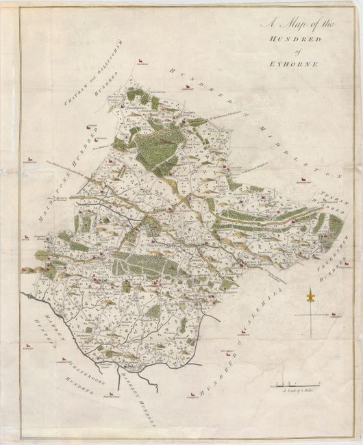
C. A Map of the Hundred of Eyhorne, by Edward Hasted, circa 1782, hand color (15.1 x 19.6"). This elegantly engraved map focuses on Eyhorne, the largest hundred in the county of Kent. There is nice detail of the wooded, hilly terrain, and towns, roads, mills, heaths, parsonages, and castles are located. Bordering hundreds are left mostly blank with the exception of some town names. Ref: cf. Shirley (BL Atlases) #G.HAST-1a #16. Condition: Issued folding with light offsetting. Backed in tissue to repair several fold separations and edge tears. There is minor loss of image near the center of the map. (B)
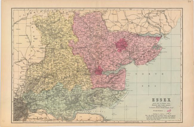
D. Essex Reduced from the Ordnance Survey, by Anonymous, circa 1890 (17.9 x 11.9"). This informative map delineates the county of Essex, located to the northeast of London, which appears at bottom left. The county is divided into West, East, and South divisions, and boroughs, towns, railways and stations, roads, rivers, and more appear. There is nice detail along the coasts, with piers, harbors, mudflats, a light vessel, and other notable features shown. Condition: There are a few small unobtrusive spots as well as an edge tear at right and two short centerfold separations in the top and bottom blank margin that have been closed with archival tape on verso. (A)
References:
Condition:
See description above.