Subject: Hungary
Period: 1730 (circa)
Publication:
Color: Hand Color
Size:
22.7 x 18.3 inches
57.7 x 46.5 cm
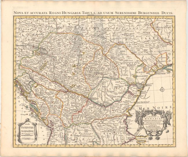
A well-engraved map with strong detail throughout with the Danube shown roughly in the center. The map extends from the Gulf of Venice to the Black Sea and shows Hungary, the Czech Republic, the Slovak Republic, and the majority of the Balkans. Rivers, roads, and towns are depicted, including Prague, Vienna, Budapest, Bucharest, Sofiya, and Constantinople. A decorative figural cartouche surrounds the title. Latin title above map: "Nova et Accurata Regni Hungariae Tabula, ad usum Serenissimi Burgundiae Ducis."
References:
Condition: A
A nice impression with original color on watermarked paper. There are some shadows that appear in the image that are caused by our scanner, and do not appear on the map itself.