Catalog Archive
Auction 149, Lot 452

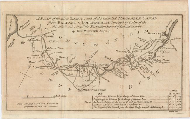
"A Plan of the River Lagon, and of the Intended Navigable Canal from Belfast to Loughneagh...", Bowen, Emanuel
Subject: Northern Ireland

Period: 1778 (published)

Publication: Gentleman's Magazine

Color: Black & White

Size:
12.4 x 6.8 inches
31.5 x 17.3 cm
Download High Resolution Image
(or just click on image to launch the Zoom viewer)

This appealing map centers on the River Lagan and stretches from Lough Neagh to just northeast of Belfast. Various towns and cities, mills, bridges, and roads are shown. A chart at bottom right indicates the distance between various destinations in the area depicted. A compass rose orients the map with the north to the upper right hand corner.

References: Jolly #LOND-263.

Condition: B+

Issued folding with light offsetting.

Estimate: $80 - $100

Sold for: $50

Closed on 5/21/2014

Archived