Subject: Texas
Period: 1864 (circa)
Publication: New Illustrated Family Atlas
Color: Hand Color
Size:
24.5 x 16.7 inches
62.2 x 42.4 cm
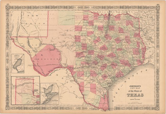
Large, handsome map with county development mostly in eastern Texas and only the three large western counties of El Paso, Presidio, and Bexar in the west. The panhandle, noted as the El Llano Estacado or The Staked Plain (Elevated Table Land, without Wood or Water), includes a large section that is unorganized. Nice depiction of the wagon roads, many named, with several completed railroads including the Houston & Guaymas R.R. Insets include Plan of Sabine Lake, Plan of the Northern part of Texas, and Plan of Galveston Bay. Decorative scrollwork border.
References:
Condition: B+
Original color with minor offsetting and light toning primarily along the sheet's edges.