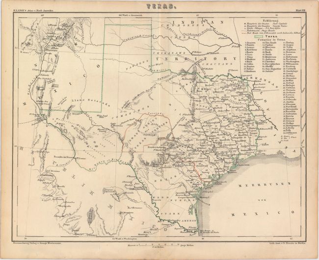
Subject: Texas
Period: 1854 (circa)
Publication: Atlas v Nord-Amerika
Color: Hand Color
Size:
10.5 x 8.3 inches
26.7 x 21.1 cm
A historically interesting county map of Texas showing good detail. A table provides a key to the symbols used to indicate towns, post offices, stage roads and list names of 65 counties. Of particular note is the identification in outline color of the Gebiet des Texas Verins with the route from the port of Indianola to the German settlements. Over half of the state is unorganized and mostly blank but it does list Indian tribes and other place names, e.g. White Sand Hills, Flatrock Ponds, Castle Mountains, Horsehead Crossing, etc.
References: Phillips (M) p. 845.
Condition: B+
Finely engraved with delicate outline coloring, minor offsetting, just a few edge tears confined to the blank margins, and light toning along sheet edges.