Subject: Rhode Island
Period: 1814 (circa)
Publication: Carey's General Atlas
Color: Hand Color
Size:
9.5 x 13.8 inches
24.1 x 35.1 cm
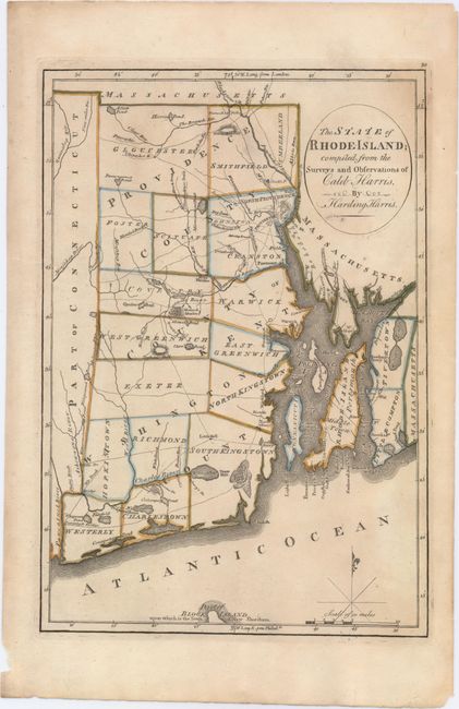
A fascinating and early look at the state that details roads, bridges, ferries, rivers, ponds, townships, and county boundaries. The northern tip of Block Island is named. Features include a small block plan of Providence, all of Narragansett Bay with Conanicut Island, and a smaller block plan of Newport. It locates Warren, Pawtuxet, North Kingstown, Mt. Hope and Mt. Hope Bay, Prudence Island, and Pt. Judith at the entrance to the Bay. All five counties are shown. A simple compass rose and fleur-de-lys with mileage scale grace the map. This boldly engraved chart was drawn by Harding Harris.
References: Phillips (A) #1372-10; cf. Wheat & Brun #250.
Condition: B+
There is a small hole in Little Compton, a touch of printer's ink residue in and around the title cartouche, and faint toning.