Subject: Pennsylvania
Period: 1850 (circa)
Publication: A New Universal Atlas...
Color: Hand Color
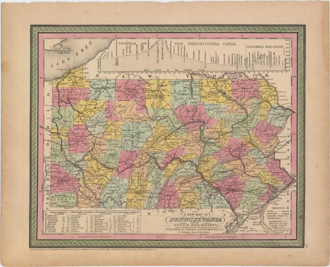
A. A New Map of Pennsylvania with Its Canals, Rail-Roads &c., dated 1850 (14.3 x 11.6"). A very handsome map with good detail throughout locating numerous towns and villages, rivers, canals, and railroads. Tables give the steamboat routes between Philadelphia to New York via Trenton, New York via Bordertown, and Baltimore via New Castle, and the route between Pittsburgh and Louisville. Also included are profile views along the Pennsylvania Canal and another along the Columbia Railroad. Decorative borders.
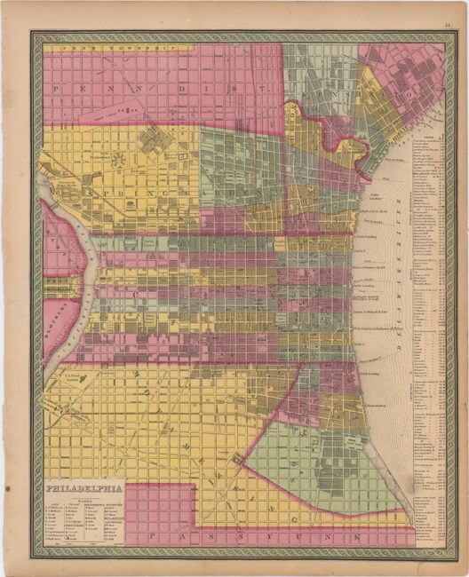
B. Philadelphia, circa 1850 (12.8 x 15.8"). This nice mid-19th century plan of the City of Brotherly Love is divided into wards as indicated in a key at bottom. An extensive index table at right lists banks, churches, hotels, and public buildings.
References:
Condition: B+
Original color with a few faint spots within the image and toning in the blank margins. The Philadelphia map has a couple minute worm holes that are only visible when held up to light.