Subject: Oklahoma
Period: 1883 (dated)
Publication: Public Domain
Color: Printed Color
Size:
16 x 12 inches
40.6 x 30.5 cm
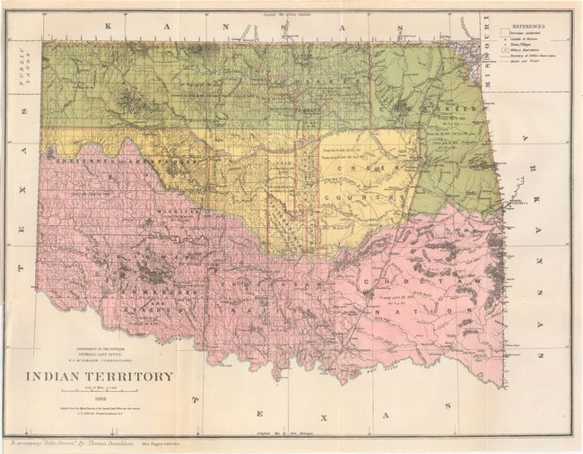
This is a reduced-size version of the large map published in the G.L.O Annual Report for 1883. The maps are virtually identical except this smaller edition neither has the surrounding notations nor a legend to explain the coloring. It is a detailed and informative map that shows the locations of tribal Indian lands and provides some data on the pertinent treaties involved. The map does not include the panhandle, which by this time is Public Lands. Blank verso. Drawn by G. P. Strum, principle draughtsman for the G.L.O. while N.C. McFarland was its commissioner. A most uncommon edition that was published to accompany "Public Domain" by Thomas Donaldson.
References:
Condition: B+
A clean example with a nearly invisible 2" binding tear that has been closed on verso with archival tape.