Subject: Southwestern United States
Period: 1864 (dated)
Publication: New Illustrated Family Atlas
Color: Hand Color
Size:
23.4 x 17 inches
59.4 x 43.2 cm
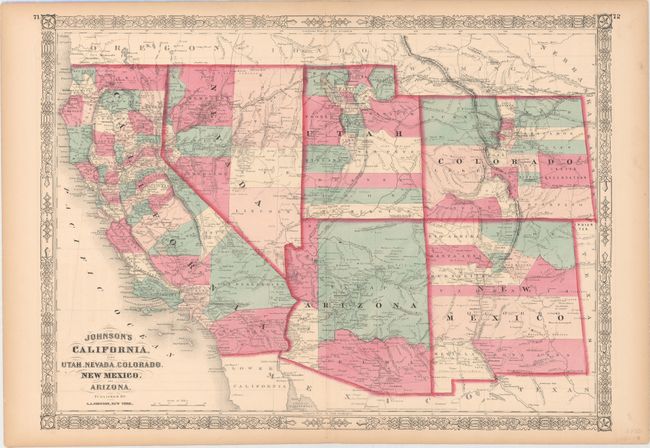
Johnson's series of maps of the American Southwest is one of the most interesting progressions in 19th century American cartography. The series was produced during a time of rapid westward expansion and changes in territorial boundaries. This edition includes the original four counties of Yavapai, Mohave, Yuma, and Pima in the newly organized Arizona Territory, with Prescott as the capital. The Utah/Nevada border is now at 114° and Arizona and Nevada have their final borders. Early historical details include the Pony Express and United States Mail routes, the emigrant roads to California, and the proposed southern railroad route. Historical and statistical information on the verso.
References:
Condition: A
Original color with faint offsetting and light toning in the blank margins.