Subject: Southeast United States
Period: 1825 (dated)
Publication: Atlas Universel
Color: Hand Color
Size:
19.4 x 18.2 inches
49.3 x 46.2 cm
Vandermaelen was the son of a wealthy industrialist who abandoned his father's business to follow a career in cartography. His goal was to produce the first atlas ever published in which every map was drawn on the same projection and to the same scale (1: 1,641,836), with each map covering an area of approximately 20 degrees of longitude (from Paris) and 6 degrees of latitude. Because of the consistent scale and projection, the maps could be joined together to form a huge globe that would measure over 25 feet in diameter. Vandermaelen had the only known globe constructed from his maps, requiring a special room for its display. It was also the first lithographic atlas ever published. There was one edition of the atlas, published in 1825-27, and the subscription list shows that only 810 copies were sold. Koeman called his Atlas Universel, "One of the most remarkable world atlases ever made. Far ahead of its time."
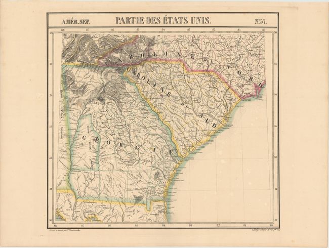
A. Amer. Sep. Partie des Etats Unis. No. 57 (19.4 x 18.2"). Covers the region from northern Florida to southern North Carolina. Shows the topography of the southern Appalachians and river system and lists numerous towns and cities. Condition: An attractive example in original color with just a few small, faint spots of foxing. (A)
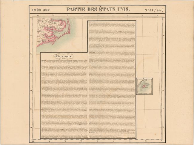
B. Amer. Sep. Partie des Etats-Unis. No. 57 (bis) (19.4 x 19.8"). This sheet, comprised mostly of text, includes the Outer Banks of North Carolina along with an inset of Bermuda. Condition: Original color with light color offsetting and a few spots of foxing. (B+)
The Atlas Universel contained 400 maps in six volumes. It was the first atlas made up of lithographed maps, and the first to present all the maps on the same scale (1: 1,641,836), with each map covering an area of approximately 20 degrees longitude (from Paris) and 6 degrees of latitude. If all the maps were joined together they would form a globe of 7.75 meters in diameter. The maps were published by subscription between 1825 and 1827, with each part containing ten maps. There was only one edition and the subscription list shows that 810 copies were sold; thus the maps are quite rare.
References:
Condition:
See description above.