Subject: Western Africa
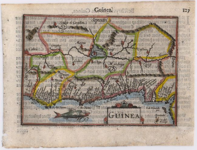
Period: 1598 (published)
Publication: Caert-Thresoor
Color: Hand Color
Size:
4.9 x 3.5 inches
12.4 x 8.9 cm
A beautiful miniature map of the west coast of Africa covering the coast from Liberia to Cameroon. The majority of the place names are confined along the coast, while the interior is largely blank except for the Niger River and a large lake. Though not signed, this map was likely engraved by Petrus Kaerius, who engraved the majority of the maps of the Caert-thresoor (Map Treasury). This is the scarce first state without degrees of latitude in the borders, published by Cornelius Claesz and printed by Langenes. Dutch text on verso.
References: King (2nd ed.) pp. 80-82.
Condition: B+
There is light show-through of text on verso, marginal soiling, and a chip in bottom right blank margin that has been repaired with old paper.