Subject: Eastern India
Period: 1672 (circa)
Publication: Wahrhaftige Ausfuehrliche Beschreibung der Beruehmten Ost-Indischen Kusten
Color: Hand Color
Size:
14.4 x 11.6 inches
36.6 x 29.5 cm
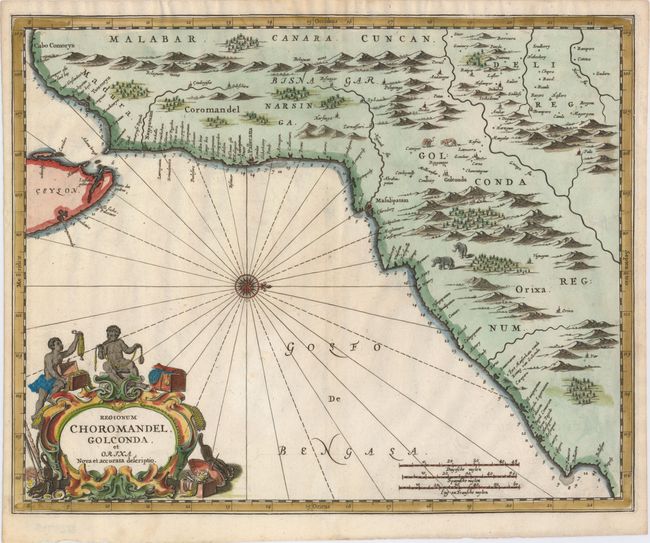
This map depicts the eastern coast of India from the Palk Strait to Baleshwar, with north oriented to the right. Numerous towns and place names line the coast, with soundings and anchorages noted along the shore. In the interior are rivers, mountains, a few place names, and depictions of animals, including pairs of elephants and leopards. The map extends to include the northern tip of Sri Lanka, with several place names and soundings noted. The strapwork title cartouche is features two Indian boys with several treasure chests and oysters with pearls. Published in Wahrhaftige Ausfuehrliche Beschreibung der Beruehmten Ost-Indischen Kusten Malabar und Coromandel Als auch der Insel Zeylon by Johann Waesberger, Philippus Baldaeus, and Johan van Somerener.
References:
Condition: A
A nice impression on watermarked paper with a few small worm holes that have been professionally infilled.