Subject: Southern Asia
Period: 1665 (circa)
Publication: Mundus Subterraneus
Color: Hand Color
Size:
16.1 x 13.5 inches
40.9 x 34.3 cm
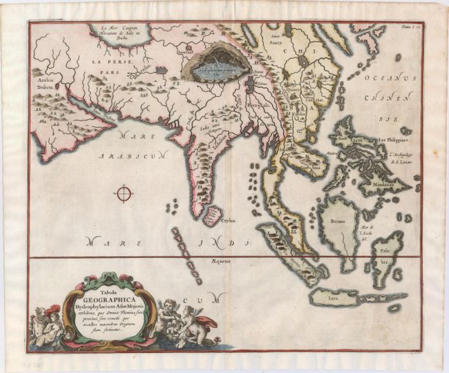
The Jesuit scholar Athanasius Kircher was one of the first compilers of semi-scientific knowledge about the physical features of the world. This very unusual map depicts all of southern Asia from the Arabian peninsula to the Philippines including the East Indies to the Celebes. It extends north to show part of the Caspian Sea. The map has limited political detail with only regions and countries named, plus the principal rivers, lakes and mountains. A huge subterranean lake in the area of Nepal and Tibet is the principle source for most of the rivers in Asia. Decorative title cartouche features angels or putti, and Neptune. Kircher's Mundus Subterraneus (The Underground World) was the first serious effort to describe the physical makeup of the earth, proposing theories (sometimes fantastic) in the areas of physics, geography, geology, and chemistry.
References:
Condition: A
A fine impression on watermarked paper with a professionally repaired worm track confined to top blank margin. What appears in the image to be toning along the centerfold is just show-through of the back strap on verso.