Subject: Western United States, Railroads
Period: 1873 (circa)
Publication:
Color: Black & White
Size:
27.5 x 6 inches
69.9 x 15.2 cm
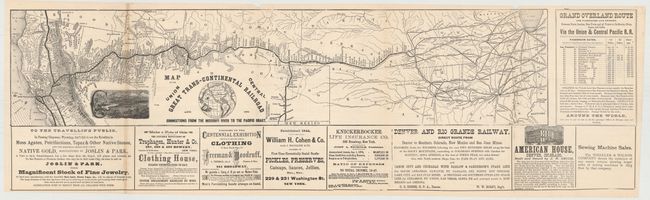
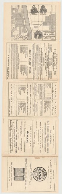
This folding map depicts the Union Pacific and Central Pacific railroad from Omaha to Sacramento and the San Francisco Bay. The map is surrounded by various advertisements for jewelry, canned goods, clothing and sewing machines to name a few. A table at right shows the passenger fares from San Francisco to various ports in Asia. On the verso is a small map (7.7 x 6") of the newly constructed railroad bridge over the Missouri River between Omaha and Council Bluffs which connected this line with points east. This map was originally included in one of Crofutt’s tourist guides. The full sheet with advertisements measures 32.5 x 10".
References:
Condition: B+
Issued folding with faint toning along one fold with a few fold separations that have been closed on verso with archival tape. There are a few minor chips in blank margins.