Catalog Archive
Auction 147, Lot 185

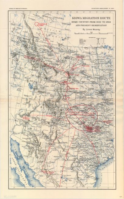
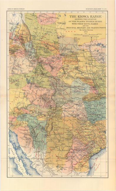
"[Lot of 2] Kiowa Migration Route Home Country from 1832 to 1868 and Present Reservation [and] The Kiowa Range Showing the Location of the Plains Tribes in 1832…", Bureau of American Ethnology

Subject: Central & Southwestern United States

Period: 1898 (dated)

Publication: Seventeenth Annual Report

Color: Printed Color

Size:
9.9 x 16.4 inches
25.1 x 41.7 cm
Download High Resolution Image
(or just click on image to launch the Zoom viewer)

These two maps cover the region from British Columbia south to Texas. The first map shows the Kiowas migration from the Black Hills area of South Dakota to their settlement in Eastern Colorado, Southern Kansas, and the panhandle of Oklahoma. The map identifies pueblos, military posts and trading posts as well as the tracks of raids and trade routes. The second map shows the numerous Plains Indians tribes in vivid color. The strong relationships between the southern Plains Indians were instrumental in keeping Spanish colonists away from the area, who instead settled in Mexico south of the Rio Grande.

References:

Condition: A

The first map has faint toning along the centerfold, else fine.

Estimate: $80 - $100

Sold for: $140

Closed on 11/20/2013

Archived