Subject: Western Hemisphere
Period: 1828 (dated)
Publication:
Color: Hand Color
Size:
29.5 x 23 inches
74.9 x 58.4 cm
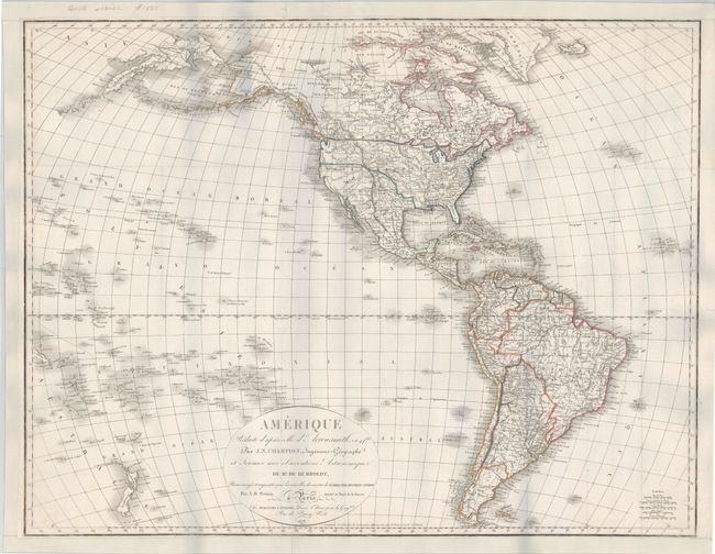
This rare French chart of the Americas is based on the map of Arrowsmith with additional information from Humbodlt’s expedition and the discoveries of Clarke, Pike, Franklin and Parry. In North America, the United States includes a large Missouri and Oregon Territory with numerous Indian tribes named. Texas is named and shown under Spanish control, while Alaska is named Amerique Russe. There is good inland detail in both North and South America, depicting numerous towns and cities, rivers and topography. Numerous islands in the South Pacific are located and identified.
References:
Condition: B+
Issued folding and now flattened and backed in heavy linen. Remargined at top and bottom, and margin extended at left.