Subject: Tahiti, Pacific Islands, Australia
Period: 1816-56 (circa)
Publication:
Color:
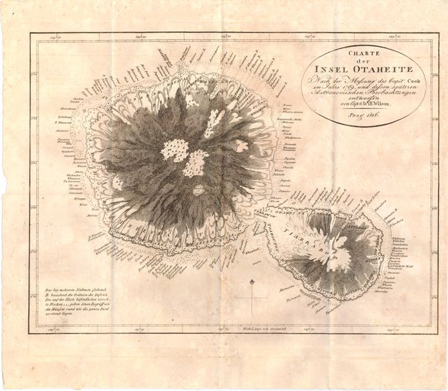
A. Charte der Insel Otaheite..., after Captain Cook, dated 1816, black & white (14.5 x 10.8"). Based on the 1769 survey of Captain Cook and improved by Captain William Wilson, this German map shows numerous place names and dramatic topography. A Wunderbarer See is located near the center of the large island. Condition: Issued folding on watermarked paper with some light scattered foxing. (B+)
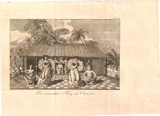
B. Ein Mimischer Tanz in Otaheite, after Captain Cook, circa 1816, black & white (8.1 x 5.7"). Attractive scene of natives performing a ceremonial dance. Condition: Issued folding on watermarked paper. (A)
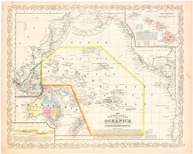
C. The Pacific Ocean Including Oceanica with its Several Divisions, Islands, Groups &c., by Charles Desilver, dated 1856, hand color (15.7 x 12.6"). Very finely engraved chart that shows all of the Pacific Ocean with a large inset of the Sandwich or Hawaiian Islands. There are numerous notes and a smaller inset that details 1800 miles of Antarctica coastline as explored by the U.S. Exploring expedition in 1840. Sea routes for Steamers are traced from San Francisco and Panama (through Hawaii) to Manila and Canton with the mileages noted. Condition: Light toning along the edges of the sheet. (A)
References:
Condition:
See descriptions above.