Subject: Southern Africa
Period: 1715 (circa)
Publication: Atlas de la Navigation et du Commerce
Color: Hand Color
Size:
20.8 x 16.7 inches
52.8 x 42.4 cm
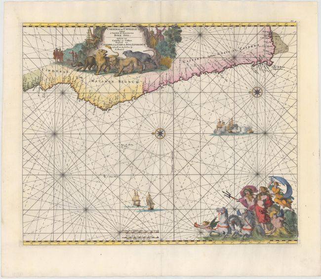
A superb sea chart with the African coastline drawn at the top of the chart with north oriented to the left. The southwestern coastline is covered including the Cape of Good Hope. The large title cartouche is a great compendium of Africa featuring exotic wildlife, European traders, and natives. At the bottom right a large vignette shows Neptune and his consort in a chariot drawn by three hippocamps. The chart is further embellished with two sea battles, two compass roses, and rhumb lines. The title is in both Latin (as above) and Dutch: Pascaerte van Cimbebas en Caffares Streckende van Catembela tot Cabo de Bona Esperanca. This is the Renard edition of the map that was first published by Frederick de Wit, circa 1675.
References: Norwich #254; Shirley (BL Atlases) M.Ren-1a.
Condition: B+
A fine impression with wide margins and a number of small worm holes and tracks along centerfold that have been professionally infilled with a small amount of rhumb lines in facsimile.