Subject: Gulf of Mexico, Republic of Texas
Period: 1846 (dated)
Publication:
Color: Black & White
Size:
38.2 x 24.6 inches
97 x 62.5 cm
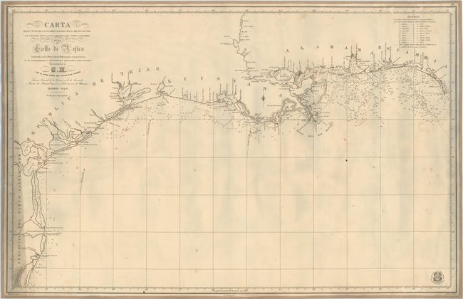
This splendid chart depicts the Gulf Coast from the San Fernando River in Mexico to Port St. Joe and Cape San Blas in Florida. The coast of the Republica de Tejas is featured, with Galveston and Corpus Christi named. This is one of the last Spanish Admiralty charts to show Texas as separate from the Union. There is also very good detail of the mouth of the Mississippi River, with New Orleans and several small towns located along the river. The coastline is filled with depth soundings, rocks, shoals, and navigational notes. A legend at top right identifies the types of ground cover in the water throughout the gulf. Lighthouses are marked with red dots. Drawn by John Carrafa based on the most recent astronomical observations and engraved by M. Moreno. The seal of the Direccion de Hidrografia appears at bottom right.
References:
Condition: B
Mounted on old linen. A nice impression with small scattered spots, a few minor pencil and ink marks, and some small abrasions in top border. There is heavy soiling at far left.