Subject: Eastern United States
Period: 1832 (dated)
Publication:
Color: Hand Color
Size:
21.8 x 17.3 inches
55.4 x 43.9 cm
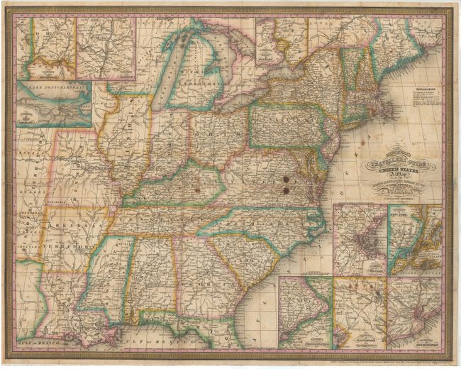
This fine pocket map shows the United States west to the Mississippi River and a little beyond to include a small portion of Missouri Territory. The map is very detailed and features nine insets; namely the Vicinity of Philadelphia, Washington, Charleston, Boston, New York, Cincinnati, Albany, New Orleans plus the Vicinity of the Falls of Niagara. The labyrinth of canals and early roads are clearly shown. The legend shows a dotted line for railroads but we can find none on this early issue. This series of maps, first published in 1832, was designed for the market represented by the burgeoning number of travelers and new immigrants. The maps were printed on thin bank note paper and folded so they could be carried easily for quick reference while traveling. This map is dated 1832 in the title making it a first edition, and was "Engraved on steel by J.H. Young & D. Haines." This example lacks the index sheet and covers.
References: Ristow, p. 304.
Condition: C+
Issued folding and now flattened and backed in tissue to reinforce and repair numerous fold separations resulting in minor loss at fold intersections. There are a few stains in Virginia and Kentucky, and smaller stains in the insets at bottom. Encased in Mylar.