Subject: Reunion Island, Indian Ocean
Period: 1850 (circa)
Publication: Atlas Universel Illustre
Color: Hand Color
Size:
17 x 11.5 inches
43.2 x 29.2 cm
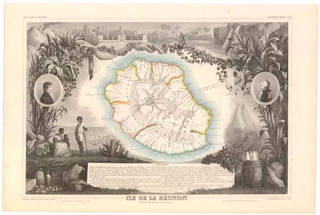
Victor Levasseur's "Atlas National Illustre" and "Atlas Universel Illustre" are among the last decorative atlases published. The maps are all lavishly illustrated with scenes of the countryside, products and activities indigenous to the region.
The island of Reunion is a French Possession in the Indian Ocean between Mauritius and Madagascar. Formerly Ile Bourbon, the island is an important sugar producer and is home to one of the most active volcanoes in the world. Its capital St. Denis is clearly delineated on the northwest coast and all principal harbors are noted around the island. The map is bordered on both sides by very finely engraved depictions of foliage, barrels, fruit, fish, and animals. Oval portrait-medallions of Bertin and Parny, the island's early governors, are engraved on either side. Text at the bottom provides additional statistical information on the island.
References:
Condition: A
Original outline color with minor toning along sheet edges.