Catalog Archive
Auction 143, Lot 172

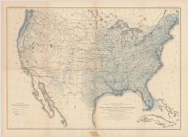
"Rain Chart of the United States Showing by Isohyetal Lines the Distribution of the Mean Annual Precipitation in Rain and Melted Snow", Powell, John Wesley

Subject: United States

Period: 1878 (circa)

Publication: Lands of the Arid Regions

Color: Printed Color

Size:
28.4 x 19.6 inches
72.1 x 49.8 cm
Download High Resolution Image
(or just click on image to launch the Zoom viewer)

This fine thematic map is a copy of the chart constructed for the Smithsonian Institution in 1868 by Charles A. Schottt. Wheat says "that such maps could now be constructed demonstrates the quantity of observational data American scientists had amassed, as well as the effective aid maps could render in the presentation of such data." Legend shows via pattern and color different annual rain falls. From Powell's report that describes the limits of the lands in the arid regions of the West. Lithographed by the firm of Julius Bien.

References: Wheat (TMW) #1290.

Condition: B+

Issued folding with a few small fold separations and light toning along the folds. There is a small stain in the lower blank margin from cello tape that has since been removed.

Estimate: $80 - $120

Sold for: $170

Closed on 2/13/2013

Archived