Subject: Western United States - Utah
Period: 1852 (published)
Publication:
Color:
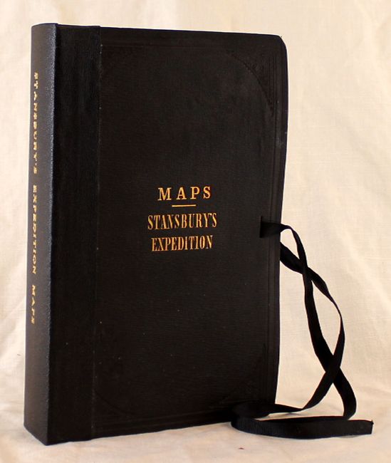
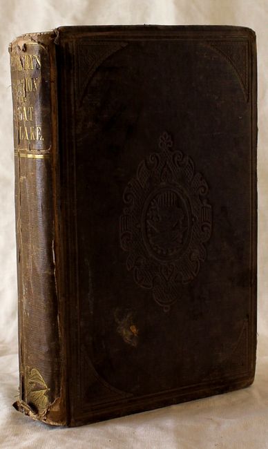
This is a great pair of maps and comprehensive report based upon Stansbury's famous explorations in Utah. The maps fold separately into hard boards titled "Maps Stansbury's Expedition" with a ribbon tie closure.
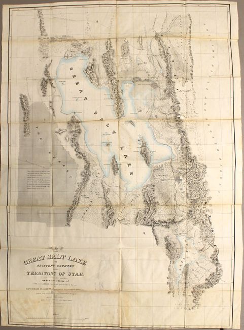
A. Map of the Great Salt Lake and Adjacent Country in the Territory of Utah, hand color, (30 x 42.3"). This map details Stansbury's important exploration of the Great Salt Lake Basin that permanently established much topography and many of the place names of northwestern Utah. It extends from the 42nd parallel and includes the Wasatch Mountains, Cache Valley and Ogden's Hole, and south to include Lake Utah and the Youab Valley. Indian, as well as Mormon, names are given for the creeks. A wonderful notation in The Desert west of the lake provides important information for travelers, "This desert consists of clay and sand impregnated with salt. When wet, it has the consistency of mortar. Lightly loaded wagons can pass between Spring Valley and Pilot Peak in the driest part of the season. Forage and water must be carried for cattle, and the journey begun in the P. M. and continued through the night. Distance between springs 70 ms." Lithographed by Ackerman. Condition: Backed with tissue to reinforce and repair numerous fold separations and short splits. There is some light toning along the folds and the bottom margin is trimmed to the neatline with some minor loss of neatline at lower right. Ex-library stamp on verso, which bleeds through to the front. (C+)
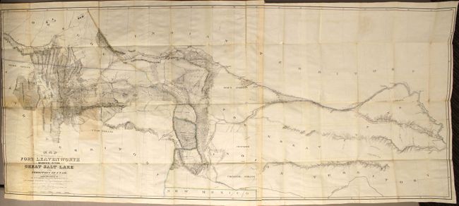
B. Map of a Reconnaissance between Fort Leavenworth on the Missouri River, and the Great Salt Lake in the Territory of Utah, hand color, (65.5 x 28"). Made under the orders of Col. J.J. Albert, chief of the Topographical Bureau, by Capt. Howard Stansbury of the Corps of Topographical Engineers, aided by Lieut. J.W. Gunnison and Albert Carrington. Drawn by Lieut. Gunnison and Charles Preuss. Thus bringing together some of the most important names in Western cartography. This immense map covers the Great Plains, Colorado, Wyoming and Utah in considerable detail on a scale of 1" to about 16 miles. The detail is particularly evident in present-day Colorado, the Laramie Mountains (here labeled Black Hills), and in the vicinity of Salt Lake. Wheat devotes more than eight pages of text to this map, calling it "one of the most important [maps] of its decade, bringing permanently into Western cartography a number of outstanding details." Lithographed by Ackerman. On two sheets joined together. Condition: Backed with tissue to reinforce and repair numerous fold separations and short splits. There is some scattered foxing at left and some light toning at left and along a few folds. Trimmed to neatline at left.
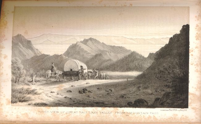
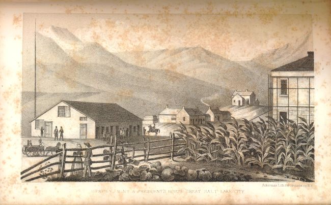
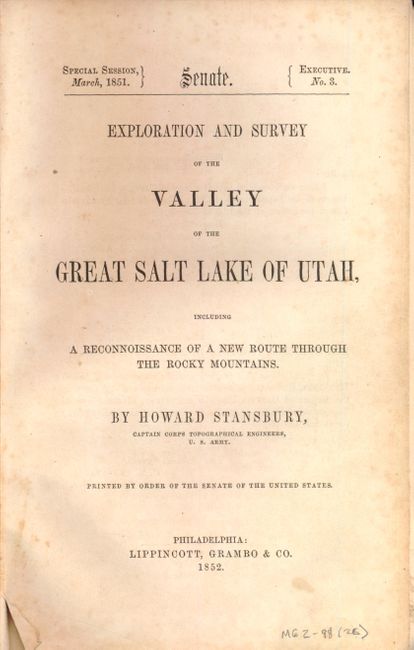
C. Exploration and Survey of the Valley of the Great Salt Lake of Utah, black & white (6.5 x 9"). A report that documents Stansbury's trek from Fort Leavenworth to the Great Salt Lake and his circumvention around the entire Great Salt Lake. Stansbury's accounts included the study of the Indian tribes, the Mormons, and an extensive appendix on Geology, Botany and Zoology. Published as Senate Doc. 3, 32nd Congress, Special Session. Octavo, 487 pp. Condition: Pages and plates are foxed with numerous pencil notations throughout. Spine is cracked and the covers are stained, bumped and worn.
References: Wagner-Camp #219:2; Wheat [TMW] #765 & #764; Howes S884.
Condition: C+
See descriptions.