Subject: North America, Texas
Period: 1840 (dated)
Publication: Atlas Universel de Geographie…
Color: Hand Color
Size:
20.3 x 14.5 inches
51.6 x 36.8 cm
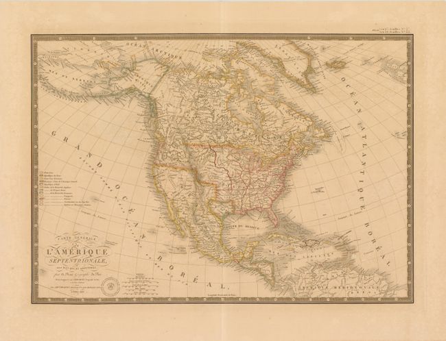
This excellent map of North America and the West Indies is beautifully engraved and features the Independent Republic of Texas. Alaska is Amerique Russe and is still a bit misshapen. The individual state and territorial borders are shown up to the Mississippi River, with the large Arkansas Territory extending over the top of eastern Texas. The legend identifies, via color, twelve different regions including the colonial holdings of France, England, Spain, Denmark, Holland, and Sweden. The handsome map includes fancy title lettering embellished with flourishes, Brue's embossed seal, and a decorative keyboard-style border.
References:
Condition: B
Original color with wide margins on sturdy paper. There is offsetting, light toning, small scattered abrasions and one edge chip in the blank margin that has been repaired on verso with archival tape.