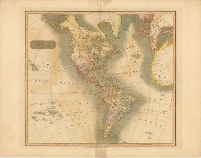
Subject: Western Hemisphere
Period: 1813 (dated)
Publication: New General Atlas
Color: Hand Color
Size:
23.5 x 19.5 inches
59.7 x 49.5 cm
In Thomson's style, this well engraved map shows the latest discoveries including those of Mackenzie, Hearne, and Lewis & Clark. The map extends to include the coasts of Europe and West Africa, and it presents good detail of islands in the eastern portion of the South Pacific. The United States is shown north of East and West Florida, and east of the Mississippi River. The land west of the Mississippi is called Louisiana and the northwest is largely void of detail. Hawaii is named Sandwich Isles.
References: Phillips (A) 731-52.
Condition: B
There is offsetting in the image and a tear that enters 1" into map at bottom that has been closed on verso with archival tape. There is an unrepaired centerfold separation at top that just passes the neatline, and one at bottom that enters 7.5" into map and has been partially closed on verso.