Subject: Western Hemisphere
Period: 1780 (dated)
Publication:
Color: Hand Color
Size:
24.3 x 19.3 inches
61.7 x 49 cm
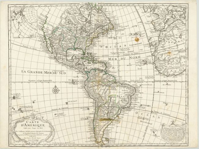
Guillaume Delisle's map of the Americas [1722] was one of the most popular maps of the 18th century with numerous editions published. Its various editions provide a great view of the evolving cartographic knowledge of the Americas throughout the eighteenth century. This is the ninth state published. In North America the western coast is now continued northward above Cap Blanc and the mythical Sea of the West has been removed from the map. The region of central Canada has been extensively updated to included several large lakes and forts. The French territory of Louisiane takes up the lion's share of North America at the expense of the British colonies. This political bias is due to Delisle's position as geographer to the King of France. The west end of Hudson Bay is completed and the names reflect recent British explorations in the region. South America is much better represented with a good depiction of the river systems and locations of the Jesuit missions. Several notations throughout the map have been extended in this edition.
References: Tooley (Amer) p. 15, #9, plt. 4.
Condition: B
Watermarked paper with some stains and a number of short tears and small holes along the centerfold mostly closed on verso with archival material.