Subject: Australia, Solomon Islands & Chile
Period: 1788 (circa)
Publication:
Color: Hand Color
This attractive lot of three French engravings are taken from Cook's first voyage around the world and focuses on his exploration in the southern hemisphere. The maps include:
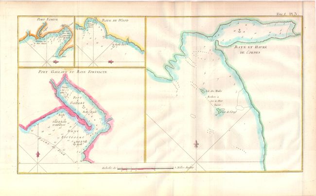
A. Baye et Havre de Cordes (14.6 x 8.6"). Displays four different charts on one sheet, focusing on Australia and Tasmania. Numerous soundings and anchorages are shown. Condition: A faint damp stain in map at left, and faint offsetting.
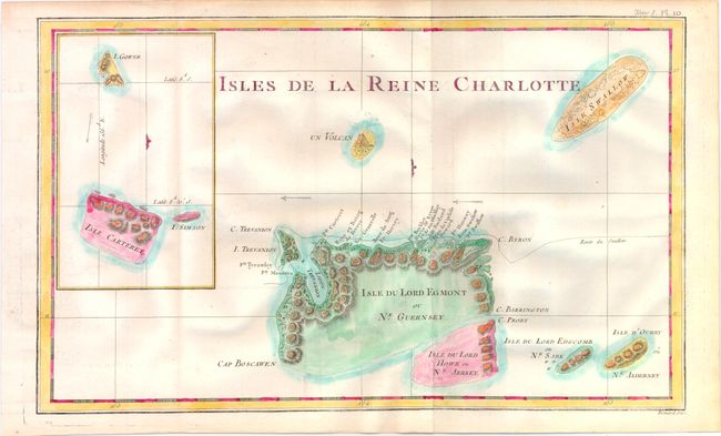
B. Isles de la Reine Charlotte (15 x 9.2"). Shows a small part of the extensive Solomon Islands located east of Papua New Guinea with a lovely erupting volcano and an inset of Carteret Island. Engraved by Benard. Condition: Minor offsetting.
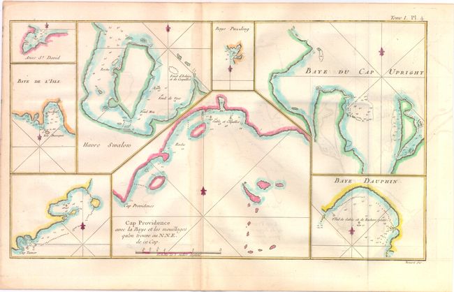
C. Cap Providence avec la Baye et les Mouillages qu'on Trouve au N.N.E. de ce Cap (14 x 8"). Displays 8 different charts on one sheet, focusing on Chile. Engraved by Benard. Condition: Light toning along centerfold and some offsetting.
References:
Condition: B+
Issued folding on watermarked paper. See description for additional details.