Catalog Archive
Auction 141, Lot 712

"Carte Reduite de la Mer du Sud", Bellin, Jacques Nicolas

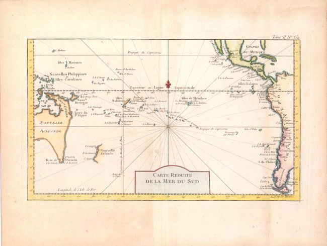
Subject: South Pacific Ocean

Period: 1764 (published)

Publication: Petit Atlas Maritime

Color: Hand Color

Size:
14 x 18.3 inches
35.6 x 46.5 cm
Download High Resolution Image
(or just click on image to launch the Zoom viewer)

This map of the South Pacific presents nice detail of the region. Eastern Australia is shown with dotted lines connecting both Tasmania and New Guinea in a conjectural coastline. New Zealand is shown with only the western coastline demarcated. The Americas are shown from Baja California through Central America and the western coastline of South America including the Straits of Magellan and Cape Horn.

References: Tooley (Australia) #158.

Condition: B+

On watermarked paper with wide margins and light, uneven toning. There is a small, archivally repaired tear just above title cartouche.

Estimate: $350 - $425

Sold for: $300

Closed on 9/5/2012

Archived