Subject: Africa
Period: 1794 (dated)
Publication:
Color: Hand Color
Size:
20.5 x 18.5 inches
52.1 x 47 cm
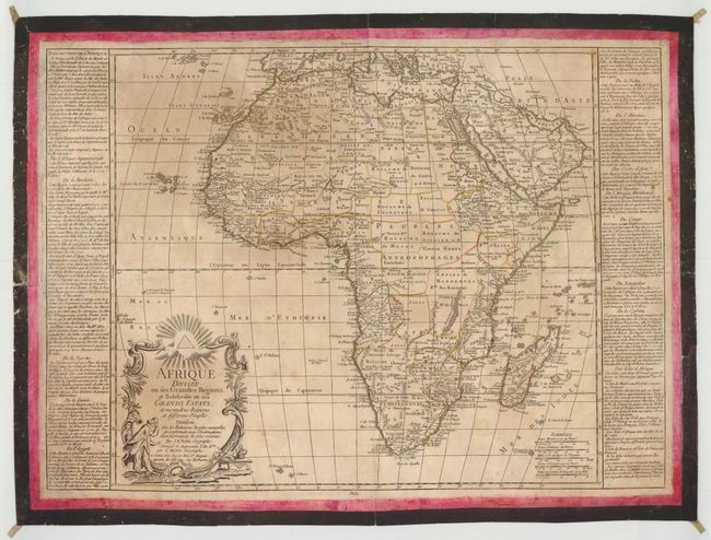
This interesting and rare map of Africa focuses on the political divisions within the continent. Place names and topographical details are relegated primarily to the coasts, with the interior still largely unexplored. Adorned with a decorative title cartouche. Panels of French text describe the various nations. Originally by Nolin, the map was "corrected and augmented" by L. Denis and published by Basset. Overall size with text on each side of map is 25.75 x 18.5".
References:
Condition: C+
Watermarked paper with original outline color. There are some minute worm holes and tracks, soiling, and light damp stains. The map was folded horizontally, resulting in a small hole at center that has been closed on verso with old linen, and a few tiny holes and short tears at left. The map features an interesting and decorative method for display; it has been surrounded by a red and black painted border, and old linen loops have been attached at each corner for hanging purposes. The borders appear to be quite old, as evidenced by the damp stains, small cracks and worm holes.