Catalog Archive
Auction 141, Lot 684

"Insula S. Laurentii, vulgo Madagascar", Ogilby, John
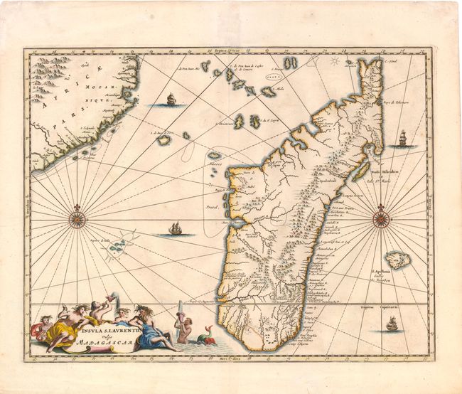
Subject: Madagascar

Period: 1670 (circa)

Publication: Africa: Being an Accurate Description of the Regions…

Color: Hand Color

Size:
14.5 x 11 inches
36.8 x 27.9 cm
Download High Resolution Image
(or just click on image to launch the Zoom viewer)

Lovely map of the island of Madagascar and coastline of Mozambique. The interior is largely filled with mountains, and place names are relegated to the coasts and rivers. The map is richly embellished with two compass roses, four sailing ships, and a large title cartouche featuring Poseidon and his sea nymphs. Ogilby based his map directly from Olivier (Olvert) Dapper's map, which was first published in Naukeurige beschrijvinge der Afrikaensche Eylanden.

References: Shirley (BL Atlases) T.OGIL-1a #32.

Condition: A

Watermarked paper with two tiny repaired holes in unengraved areas of the map near the title cartouche.

Estimate: $300 - $400

Sold for: $220

Closed on 9/5/2012

Archived