Subject: Jerusalem, Holy Land
Period: 1715 (circa)
Publication:
Color: Hand Color
Size:
16.5 x 13 inches
41.9 x 33 cm
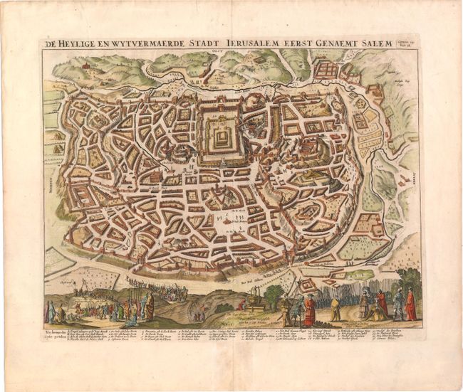
This detailed bird's-eye plan was one of the most popular plans of Jerusalem during the seventeenth century. While it is imaginary, it provides great detail of the city walls and streets, with 36 principal sites numbered and keyed to a table below the map. Solomon's Temple is at upper center and Herod's Palace is located at the far left. Biblical scenes are shown on the hillsides in the foreground, including the crucifixion and Salomon being anointed king. This is a later issue of Cornelius Danckert's map, published by Isaac van der Putte.
References: cf Poortman & Augusteijn #104.
Condition: B+
Wide margins with minor soiling and a couple of archivally repaired tears in blank margins. A centerfold separation confined to the bottom blank margin has also been archivally repaired.