Catalog Archive
Auction 141, Lot 42

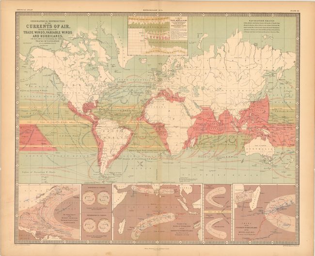
"Geographical Distribution of the Currents of Air, Showing the Regions of the Trade Winds, Variable Winds and Hurricanes, with their Effects in Determining the Different Tracks of Navigation", Johnston, Alexander K.

Subject: World

Period: 1854 (dated)

Publication: The Physical Atlas of Natural Phenomena

Color: Printed Color

Size:
24.5 x 20 inches
62.2 x 50.8 cm
Download High Resolution Image
(or just click on image to launch the Zoom viewer)

Attractive thematic map from the English version of Heinrich Berghaus' Physikalischer Atlas, the first truly comprehensive thematic atlas. This is a very early example of printed color, the development of which made a huge impact on cartography in general and specifically on the graphic portrayal of geographical data on thematic maps.

The map itself shows very good detail of the trade winds and its associated impact on navigation. Numerous routes are drawn in thin red lines and indicate the traveling days required between locations. The red shaded areas near the equator indicate regions prone to monsoons and hurricanes. At bottom are insets showing the track of hurricanes in the Atlantic and Indian Oceans. Surrounded in a keyboard style border.

References:

Condition: B+

There are centerfold separations at top and bottom that extend 1.5" and 1" respectively past the neat line, with a hint of toning along the edges of the sheet.

Estimate: $90 - $110

Sold for: $65

Closed on 9/5/2012

Archived