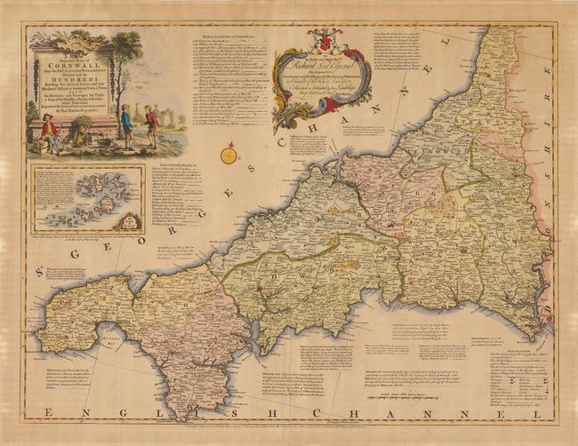
Subject: Cornwall, England
Period: 1750 (circa)
Publication:
Color: Hand Color
Size:
27.3 x 20.5 inches
69.3 x 52.1 cm
This attractive engraving shows the county of Cornwall with political districts delineated, along with an inset of the Isles of Scilly off Land's End. The map shows quite a bit of detail including roads, rivers, mountains and includes numerous notes about important towns in the county. The map is adorned by a decorative title cartouche reflecting the rich wildlife, agriculture and mining resources in the area. An additional cartouche dedicates the map to Richard Edgecumb, Lord Lieutenant of Cornwall from 1742-58.
References:
Condition: B
Moderate toning, a few faint spots, and centerfold separations at top and bottom confined to the blank margins. The verso is more heavily toned, although the paper is still quite supple.