Catalog Archive
Auction 141, Lot 384

"Carte Reduite des Parties Septentrionales du Globe, Situees Entre l'Asie et l'Amerique pour Servir a l'Histoire Generale des Voyages", Bellin, Jacques Nicolas

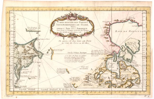
Subject: Arctic Ocean

Period: 1758 (dated)

Publication: Prevost's Histoire Generale des Voyages

Color: Hand Color

Size:
13.7 x 8.3 inches
34.8 x 21.1 cm
Download High Resolution Image
(or just click on image to launch the Zoom viewer)

Very unusual chart that shows only the northeast coastline of Canada with Baffin and Hudson Bay and the St. Lawrence River. On the other side is the northeast coastline of Asia with the Kamchatka peninsula. In between are a few small areas of coastline with notations concerning reported explorations, including those of Juan de Fuca, the Russian expeditions in 1728 and 1741, the reported Sea of the West and the English quests for a Northwest Passage via the Hudson Bay.

References: Kershaw #1115.

Condition: B+

Issued folding, now pressed on watermarked paper with a couple of minor spots. A binding trim at bottom right has been closed with old paper, and a resulting 1" binding tear has been professionally repaired.

Estimate: $180 - $220

Sold for: $130

Closed on 9/5/2012

Archived