Subject: Greenland, Canada
Period: 1765 (dated)
Publication:
Color: Hand Color
Size:
34 x 21.5 inches
86.4 x 54.6 cm
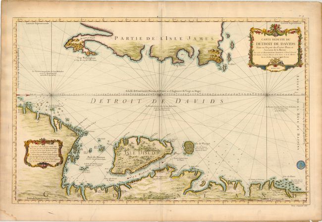
This large-scale sea chart of the Davis Strait was created for whaling ships, and illustrates the importance of offshore activities in the region. Oriented with north to the right, the coastline of Greenland at the bottom of the map is well detailed with place names, soundings, water currents, and anchorages. In contrast, the eastern coastline of L'Isle James (Baffin Island) is only partially outlined. This map is based on a similar map by Gerard van Keulen from 1719. The seal of the Depot de la Marine is at bottom right, with Prix Cinquante Sols below the neatline.
References:
Condition: B+
On heavy, watermarked paper with light soiling and a few short printer's creases that just enter map image at top and bottom. There is light toning and a few short tears in blank margins, as well as a small damp stain in bottom left corner, far from map image.