Subject: Cape Verde Islands and Goree Island
Period: 1746-1760 (circa)
Publication: Prevost's Histoire Generale des Voyages
Color: Black & White
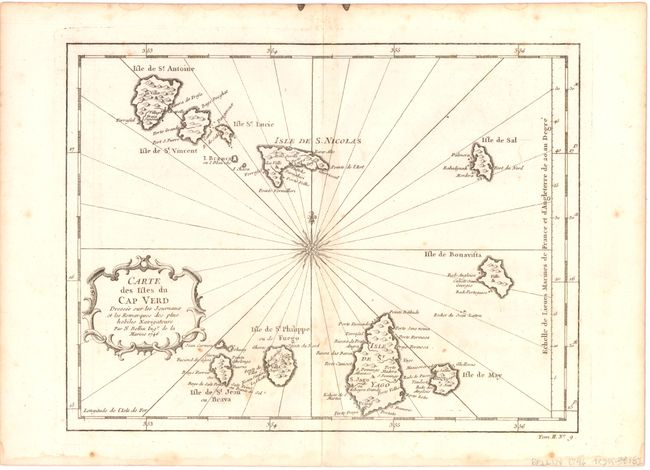
A. Carte des Isles du Cap Verd Dressee sur les Journaux et les Remarques des plus Habiles Navigateurs, dated 1746 (11.1 x 8.4"). Charming small map of these important Atlantic islands showing topography, ports and towns. The chart is centered on a fine compass rose and adorned with a delicately engraved title cartouche. Condition: On watermarked paper with light toning along the centerfold, a few minor spots, and a light damp stain in bottom blank margin, not affecting map.
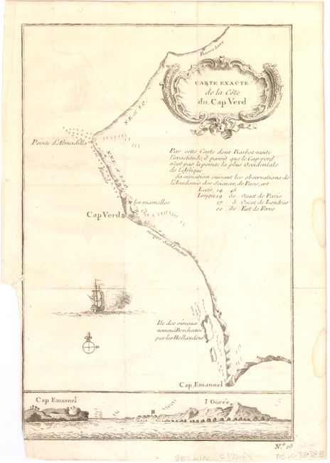
B. Carte Exacte de la Cote du Cap Verd, circa 1760 (5.6 x 8.6"). A nice plan of the coastline showing the navigation hazards with a view at bottom of Cap Emanuel and I. Goree. Decorative title cartouche and a ship sailing along the coast. Condition: Issued folding with light offsetting and light damp stains in right blank margin, not affecting map. There is a binding trim with minor loss of neatline at bottom left and a small binding tear that just enters neatline.
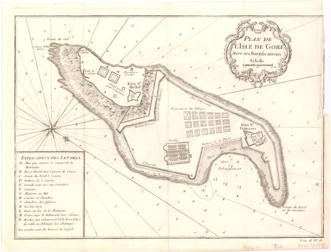
C. Plan de l'Isle de Gore Avec ses Fortifications, circa 1760 (10.8 x 7.8"). A plan of the island with a details of the fortifications and village. Decorated with a French style cartouche, compass rose and rhumb lines, with a key to the map at left. Condition: Issued folding on watermarked paper with a binding trim at right with some loss of neatline and a tiny binding tear that just passes neatline.
References:
Condition: B+
See description above.