Subject: World
Period: 1750 (dated)
Publication:
Color: Hand Color
Size:
26.9 x 19.5 inches
68.3 x 49.5 cm
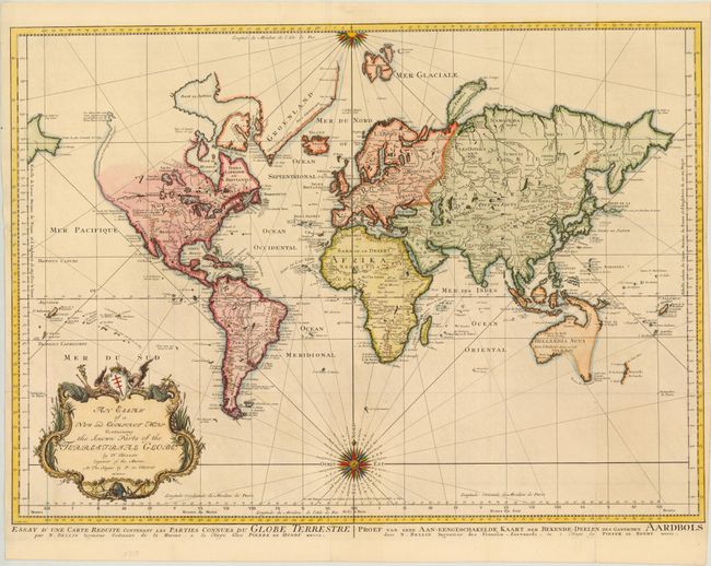
Bellin's popular world map is presented on Mercator's projection with two fine compass roses orienting the chart. North America is shown with a very pronounced River of the West connecting through a series of rivers and lakes from Lake Superior to the Pacific - representing the elusive Northwest Passage. A portion of the Asian coastline is depicted a short distance from the supposed western coast. The Russian discoveries in the North Pacific are not yet shown, although there is a note about the voyages of 1743. Able Tasman's new discoveries in New Zealand and Australia are shown. Australia is labeled Hollandia Nova with Nova Guinea linked to the mainland by the Carpentier coastline. Terre de Diemen, also labeled I. Tasman, is connected to the mainland by conjectural dotted lines. A large, decorative title cartouche completes the composition. Published by Peter de Hondt with titles in French and Dutch in lower margin.
References:
Condition: B+
Issued folding, now pressed on heavy, watermarked paper. There is a tear that enters 1" into map at left that has been closed on verso with old paper, and there are a few minor fold separations that have been archivally repaired. Fold intersections have been reinforced with archival tape.