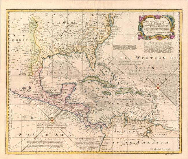
Subject: Gulf of Mexico and Caribbean
Period: 1744 (circa)
Publication: John Harris' Navigantium Atque…
Color: Hand Color
Size:
17.8 x 14.5 inches
45.2 x 36.8 cm
A handsome map of the Caribbean and Gulf coasts with well engraved detail and many remarks on sailing directions, history, and native populations. The trade winds are noted with directional arrows, and the major trade routes are delineated. The coastal place names are abundant, with some towns and fortifications named inland. An early reference to the first attempted colony in Texas is Cenis Ft. on the banks of the Trinity River. In today's Colombia are noted Gold Rivers and Mines and a Dutch Colony is located in Surinam. The map is filled with extensive, interesting notations on the Spanish Galleons, John Oxnam and the Isthmus of Darien, King Charles II and the granting of the Carolina charter, and much more. A decorative cartouche and two compass roses complete the composition.
References: Shirley (BL Atlases) G.HARR-1a #17.
Condition: B+
Just a hint of toning along centerfold.